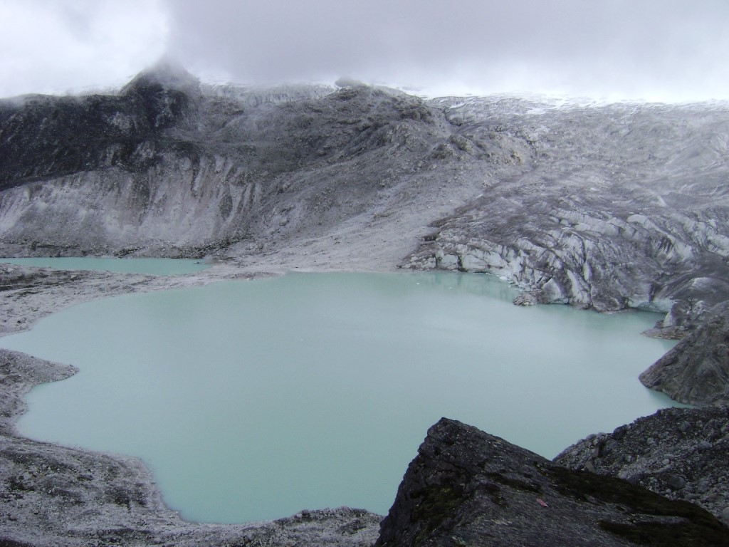
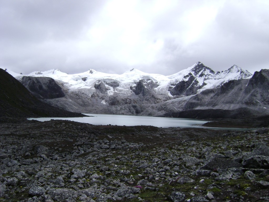
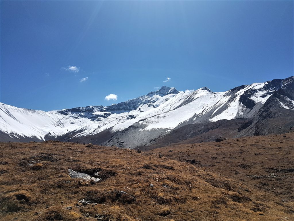
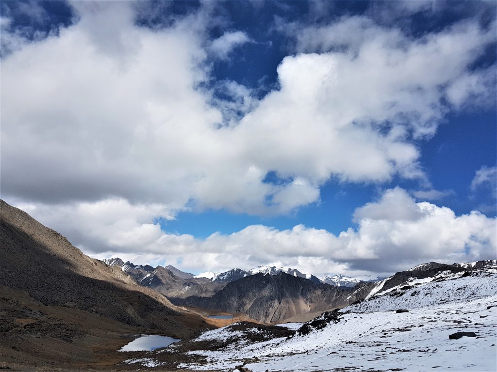
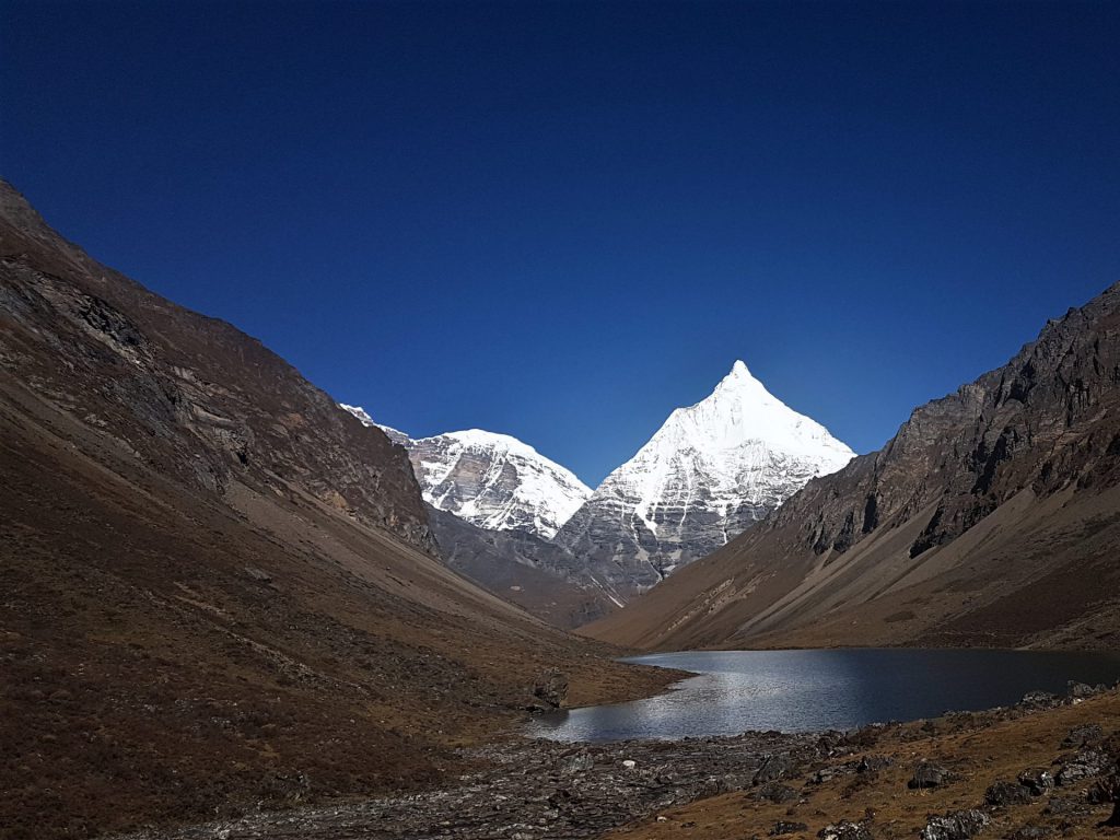
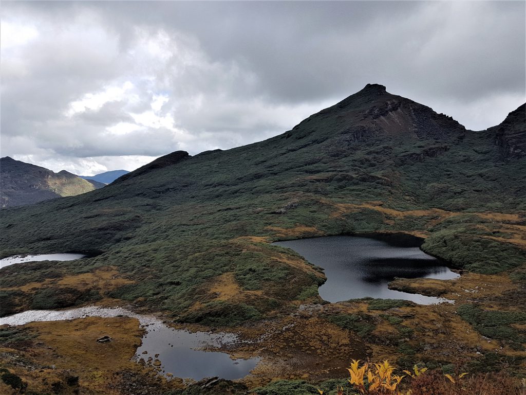
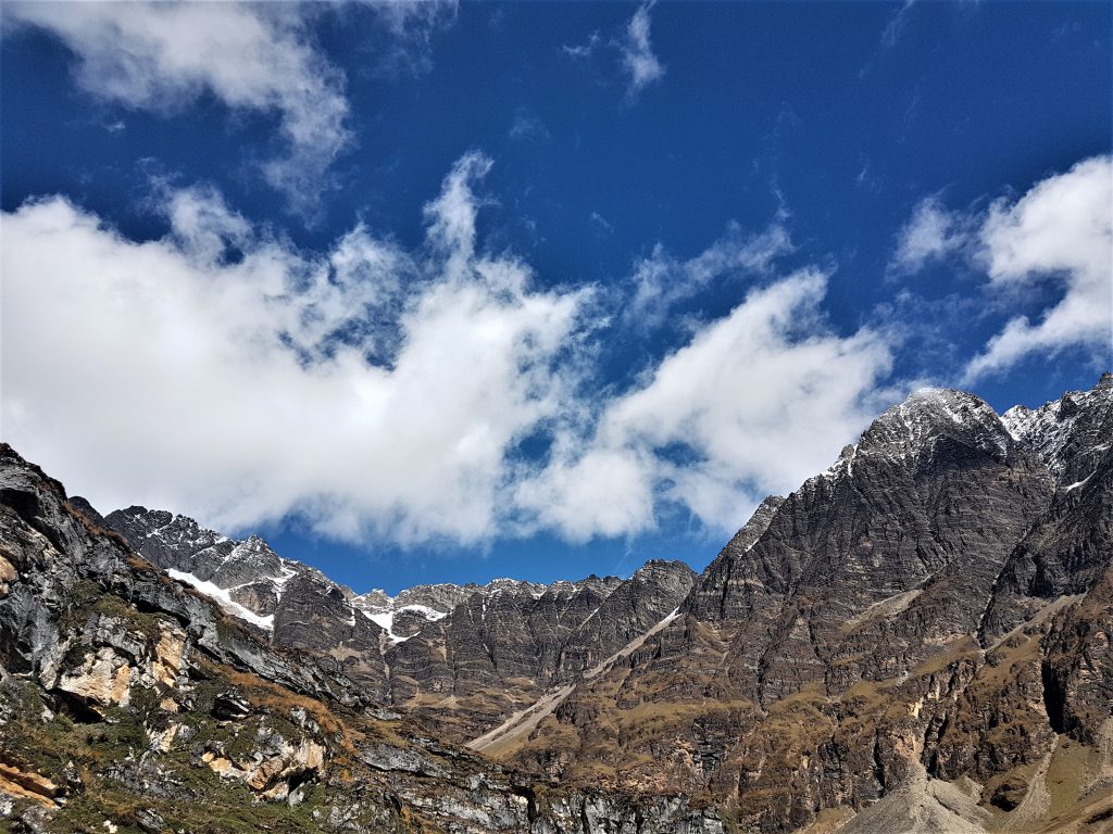
One of the toughest and most challenging treks in the world, Snowman Trek is an extension of the beautiful Laya-Gasa trek and leads from Laya into high altitudes of the Bhutan’s Himalayas. This spectacular adventure is an incredible experience for those who grapple the challenges.
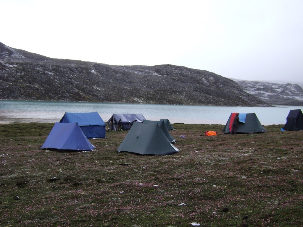
Trek takes you through remote villages of Lunana, high passes, ridges from where one can truly appreciate the rugged beauty of your surroundings and the mountain vegetation. The trek leads through the most remote areas and can be undertaken with optional routes at the end: One that end in Sephu, Trongsa and other with Dur in Bumthang, depending on which route you choose. Trekkers have to camp in altitudes above 5,320m more than once, and depending on the seasonal temperatures, the camps are sometimes on snow also.
Season: The best months for this trek are; September & October.
Day 1
Arrive Paro
The flight to Paro is one of the most spectacular in entire Himalayas. Whether flying along the Himalayan range from Kathmandu or over the foothills from Kolkatta, the journey offers fascinating views and an exciting descent into the Kingdom. Bhutan’s first gift to you as you disembark from the aircraft will be cool, clean fresh mountain air. After immigration formalities and baggage collection, you will be met by our representative, and afterwards drive to the hotel.
Depending on the arrival time, you may be able to see few places in the late afternoon or evening, that may include visit to Paro Rinpung Dzong and a short familiarization tour of Paro town.
Paro: The small and charming town of Paro lies in the center of the valley at an average elevation of 2280m, on the bank of Pa Chhu River. Paro town was first formed in 1985 with one main street, lined with colorfully painted shops. Of recent, new constructions have taken place parallel to main street. The head quarter of Paro district is located in nearby Rinpung Dzong. Bhutan’s international airport is also located here, and the capital is just over one hour away. Paro is known to be most fertile valley. It is one of the most historic valleys in Bhutan too. Both trade goods and invading Tibetans came over the pass at the head of the valley, making Paro the closest cultural connection with Tibet of any Bhutanese district.
Paro Rinpung Dzong: This Dzong was consecrated in 1645 by Shabdrung Nawang Namgyal on the site of smaller fort. Throughout the 17th and 18th centuries it served as a bastion against invasion from the north. It is regarded as one of the finest Bhutanese architecture – with intricate woodwork, large beams slotted into each other and held together without nails. In it houses the giant 30m X 45m Thangka (Thongdrol), commissioned in mid-18th century, displayed on the last day of Paro Tshechu (festival). Rinphung Dzong is the district headquarter of Paro and residence of state monks under Paro rabdey.
Overnight at the hotel in Paro. (Altitude 2,280m)
Day 2
Paro
In the morning, drive to the north end of the valley, and visit the ruin ramparts of Drugyal Dzong. Visit 7th Century Kyichu temple, National Museum and in the afternoon, transfer to Bondey village and take a short walk through the village to cliff hanging monastery of Dzongdrakha, spectacularly situated with the views of large country houses.
Drukgyel Dzong: Currently under restoration, is located 14kms north of Paro town, near the end of the paved road. Its name means victorious fortress and was built 1644-49 to commemorate the Bhutanese victory over the Tibetan-Mongol forces. It was later burnt in fire by accident in 1951. On a clear day, Mt. Jomolhari (7,314m), Bhutan’s holy peak can be seen against its backdrop.
Kyichu Lhakhang: Kyichu Lhakhang or Kyerchu Temple is located short distance north of Paro town. It is one of the oldest and most beautiful temples. The temple is popularly believed to have been built in 659 A.D by King Songtsen Gampo of Tibet, to pin down ‘the left foot of the supine Ogress’, which was thwarting the establishment of Buddhism in Himalayas. Kyichu is said to be one of the main 12 temples of the 108 temples that were built overnight across Tibet and borderlands. The temple was adopted by different sects and many important Buddhists teachers spent time here and unearthed concealed teachings (terton). The inner hall of the main Jowo Lhakhang shrine conceals the original 7th century Jowo Jamba Statue. Its central image of Jowo Jamba is flanked by eight standing Bodhisattvas and by statue of Zhabdrung and Guru Rinpoche. The outer hall of the Jowo contains statue of Chenrizig with 11 heads and 1000 arms. Attached to Jowo Lhakhang is Guru Lhakhang temple, which was constructed by Queen Mother Ashi Kesang Wangchuk in 1968 and its principal image is 5m statue of Guru Rinpoche. Also here is a chorten, containing ashes of of Dilgo Khyentse Rinpoche, a highly revered Buddhist master, and spiritual teacher of Queen Mother who passed away in 1992 and was cremated nearby.
Ta Dzong (National Museum of Bhutan): Established in 1967, the museum is housed inside a circular ancient watchtower. It has fascinating collection of arts, relics, and religious thangkha paintings, household’s stuffs, arms, handicrafts, stuffed animals and Bhutan’s famous Stamps among others.
Dzongdrakha Gompa: From the little town of Bondey, near the airport, walk for about ½ an hour to Dzongdrakha, a group of temple monastery with retreat center overlooking the Paro Valley. The temples are situated on the cliffs above the terraced fields of Bondey. The temples were built in the 16th century by the first local king, Chogay Dragpa. The four temples are dedicated to Tara, Tsheringma, Guru and Jowo Jampa.
Overnight at the hotel in Paro. (Altitude 2,280m)
Day 3
Paro (Taktshang Monastery Hike)
After breakfast, transfer to the trailhead and hike to legendary Taktsang (Tiger’s nest) monastery. Depending on how you will feel, we may hike beyond Takstang, to visit other temple and monasteries higher up.
Upon return from the hike, you can prepare your luggage for the trek. Things you don’t need during the trek can be left behind.
Taktshang – Tigers Nest: Often referred to as Taktshang Pelphung monastery, it is one of the most venerated and famous of Bhutan’s monasteries, located on the face of a 900m sheer cliff. It is an impressive and unmissable site, but accessible only by walk or to ride mules/pony. From the trail head at Rumtokto (2600m), the walk till the Cafeteria is a steep one-hour uphill (about 350m ascent). From the Cafeteria (2940m), one can get a good close-up view of Taktshang. Savor views of the monastery over a well-deserved cup of tea and biscuits at the cafeteria and continue uphill for another 45 minutes to a high observation point (3140m) where there is a Chorten. From this vantage point, the lookout to the monastery is really spectacular and seems almost close enough to touch. It is now on the other side of a deep chasm, only around 150m away as bird flies, but takes half hour or even more to reach. Continue down the flight of cliff-hanging steps on the narrow trail to a beautiful waterfall that plunges down the deep chasm and alongside is a retreat hermitage, jammed dramatically into a rock crevice. Then climb up the flight of steep steps to the monastery. At any point on this walk, you can always return if you find it too difficult. Once inside the monastery, there are several shrines or temples with few monks in residence.
After visiting Taktshang monastery’s many shrines, most tourists schedule lunch at the Cafeteria upon return. After lunch, retrace back to the road-head where you started in the morning. The return from Cafeteria is all downhill and takes just over half hour. Further, if you have more time, energy and ready for more challenging day, you can start early and trek beyond Takstang to see several monasteries, temples, retreat houses in the surrounding area. The most notable among them are Zangdopelri and Ugyen Tsemo. Pony/horse can be hired for ride up till the Cafeteria. However, you cannot ride beyond the cafeteria or come down hill on the horse. According to the legend, Guru Padmasambhava or Guru Rinpoche, who spread the Buddhism across the entire Himalayas is said to have flown here in the 8th century on the back of a Tigress, in order to subdue negative spiritual forces that were hostile to spread of Buddhism. In 853, one of his students, Pelgyi Senge mediated here in the main cave. The stupa inside one of the temples contains his mortal remains and therefore the cave is known as ‘Pelphung or Pelgi’s cave’. Subsequently many great spiritual masters such as Milarepa, Thangthong Gyalpo, Phajo Dugom Zhigpo, Shadrung and many others, passed periods here in profound meditation. In 1692, Tenzin Rabgye built a two storey temple around what little may have existed previously. This was expanded and refurbished many times over the period of time. Taktshang and several temples in the area were burnt down in 1951 by fire accident but much of them remained intact and most of the relics were saved. Soon after, the, Taktshang was rebuilt by population of Tsento village. Again, in April of 1998, a major fire destroyed the main structure of the building and its contents (some believe it to be arson). Reconstruction began in 2000 and was completed and consecrated after extensive efforts and financial support of Governments as well as donors.
Day 4
Paro – Thongduzam
Distance- 8-9 km, 3-4 hours trek, Camp altitude 3150m
From Paro, drive north-west for 30 minutes to the end of the surfaced road at the ruins of Drukgyel Dzong (2530m). From here continue following a farm road for around 1 – 1.5 hours, passing through small hamlets of houses built in traditional Bhutanese design. Arriving at the end of the farm road at Shana (2860m), meet your crews. Handover your luggage to be brought on the trek (And leave behind anything that you need after the trek). Preparing your luggage for horses take a bit and so you can wander around. Once it is loaded on the ponies, we will set off following a path beside the river before climbing through beautiful lush forest of oak, rhododendron, bamboo and pine, pass the 2-house hamlet of Shing Karap. Beyond here the trail forks with one path leading across the Tremo La (forbidden pass) to Tibet. We take the other path following the main river. We make a steep climb and descent to cross the river on a bridge and soon after we reach the clearing of Thongduzampa where we make camp.
Overnight Camp.
Day 5
Thongduzam – Soi Thangthangkha
Distance – 8km, 3-4 hours trek, 500m ascent, 100m descent, Camp altitude 3575m
Today is a short day of trekking, but it is important to gain height gradually. Continue along the river through a magnificent forest of pine and spruce, mixed with oak, birch and maple as the valley begins to narrow. In some areas, the trail can be muddy, especially after the rain. There are many small ups and downs as we follow the river north. After crossing a bridge, we make a short climb to reach a junction of two valleys, marked by a large chorten, from where (weather permitting), we can see Mt. Chomolhari at the head of the valley. Our trail stays on the west bank of the Paro Chu and the campsite is only half an hours’ walk from here at Soi Thangthangka.
Overnight Camp.
Day 6
Soi Thangthangkha – Jangothang
Distance – 15km, 5 – 6 hour trek, 550 ascent, 100m descent, Camp altitude 4080m
Cross a small army post and a chorten and then, leaving the forest behind, we enter more open country, surrounded by high ridges and snowcapped peaks. The trail continues through lovely juniper forest, past few yak-herder’s villages. Our camp is a little further on, a beautiful grassy meadow beneath the enormous east face of Chomolhari, by a ruined dzong (4080m).
Overnight Camp.
Day 7
Jangothang Rest or exploration day
Today is a scheduled rest day, intended to aid acclimatization before the crossing of the high passes. Jangothang is one of the most spectacular camping places in the Himalayas. Snowcapped peaks form the western side, with clear stream running through the valley, surrounded by yak herder’s villages, and trout filled lakes to visit. One possibility is to hike up the ridge to a grassy summit at approximately 5000 meters, from where there is an incredible close-up view of Mt. Chomolhari and its glaciers. The cooks will have had all day to prepare a small feast for your dinner.
Overnight Camp.
Day 8
Distance – 18 Km, 7 hours trek, 840m ascent, 870m descent, Camp altitude 4010m
By now, you will have well acclimatized, but if you feel any altitude sickness, it is a best point from where to return back towards Paro instead of continuing on. Begin by following the river, cross the bridge near the house, and climb steeply up with the views of Mt. Jichu Drake, Jumolhari and the adjoining peaks into a glacial valley with many moraines. We are above tree lines with few small gentians, but otherwise it is just grass, tundra and small juniper bushes. You may be able to spot blue sheep on the hillsides and see mountain marmots. As we near the ridge, Tserim Kang (6789m) begin to appear. After about 4hours’ trek from Jangothang, arrive at Nyile La pass (15,970’/4870m). From here the views of Chomolhari, Jichu Drake, and Tserim Kang are spectacular. From the pass descend steeply at first, to follow a long ridge before finally dropping through forests of rhododendron and pine to our camp beside the river (4010m).
Overnight Camp.
Day 9
Distance – 10 Km, 5 hours trek, ascent 280m, 410 descent, Camp altitude 3880m
One of the short trekking days but a fascinating one. Climb up to Lingshi Dzong, then a delightful path contours the hillside, passing numerous farms with good views across the valley of the Peaks, and arrive at Lingshi school and village. Lingshi region is known for medicinal plants and there is large collection center here. After a look around, walk out on along the hillside covered with wildflowers, as the trail traverse high and reaches a cairn and ridge, before descending to picturesque Goyul village with beautifully designed stone houses. Leaving Goyul, the path continues along the hillside for another hour to arrive at a spectacular fairy-tale-like setting of Chebisa village; located below the waterfall,
with meandering creek, surrounded by ridges. The old stone houses with wooden slatted roofs clustered together, feels as though it is forgotten in time. Our campsite is on the opposite bank of the creek, at 3880m.
Overnight Camp.
Day 10
Chebisa – Shomuthang
Distance – 15 Km, 6-7 hours trek, 890m ascent, 540m descent, Camp altitude 4220m
From the village, begin by climbing uphill on a steep slope. Several large herds of blue sheep are commonly sighted in the area. You should be able to see bearded vultures, griffons and many eagles, soaring overhead. You may see few Yak headers and their campsites in these areas. The trail begins to level and traverses Gobu-la at 4440m (a ridge crossing). After Gobu la, make few ascends and descend crossing ridges and side valleys, through rhododendron forests, crossing stream, then over ridges, through cedar forests, fir and birch trees. The camp site is on a bench above Shagipasa river (4220m.) The valley is beautiful with clear streams, rich forests, and stunning mountain scenery
Overnight Camp.
Day 11
Shomuthang – Robluthang
Distance – 16 Km, 7 hours trek, 700m ascent, 760m descent, Camp altitude 4160m
As the walk is bit difficult, it is advisable to start little early. From the campsite, climb up for about 2hours to Jhari La (4750m). Stunning view of Mt. Gangchenta ‘Great tiger mountain’(6840m), Kangbum(6526m), and Tsherim Kang and also the tip of Chomolhari can be seem from the pass. The scenery on this day’s walk is breathtaking. Descend to Tsharijathang valley, which has been declared sanctuary for Takins (national animal of Bhutan). It is quite common to see herds of this unique creature here. Cross a river and camp in a scenic position just half an hour’s walk up the hillside at Robluthang (4160m).
Overnight Camp.
Day 12
Robluthang – Lemithang
Distance – 18 Km, 6-7 hours trek, 850m ascent, 870m descent, Camp altitude 4140m
Today is another long and hard day, crossing Shingela pass, the highest point on this trek. Follow the stream for a while, then climb onto moraine at 4460m. Along the slopes, you will see lots of Blue sheep and probably some Takins. As you near the pass, it gets tougher, because of high altitude. After about 5 hours trek from the campsite, arrive at Singe la pass at 5005m, where the snow covered Gangchenta, fills the horizon to the north. Descending from the pass, the trail follows moraine into another glacial valley. Cross the Kango chu steam and follow the valley to the north, through cedar forests interspersed with small meadows to a lovely campsite in a big meadow by the river at Lemithang(4140m), with Gangchenta peak towering in the backdrop.
Overnight Camp.
Day 13
Lemithang – Laya
Distance – 9.5 Km, 4-5 hours trek, 60m ascent, 340m descent, Camp altitude 3,840m
Though shorter than some of the days so far, there is still quite a lot of ups and downs. Walk through the cedar forest, cross a small steam and make a decent to valley and then climb again and walk through the heavily wooded area. After about 4 hours trek, you will see the first house on the outskirts of Laya. There are two trails just before Laya. One leads to the upper Laya and you will be able to see the village and fields from the top. The lower path leads to directly near the village, which is near the Middle School at 3840m. Ganchenta and Masangang (7165m) dominates the skyline. This is also the first shop after we leave Paro. Free afternoon to wander around this fascinating village, meet its friendly people. The women with their pointed hats, and highly decorative jewelry, make a striking picture. Tonight, you may be able to watch dances and singing by the locals.
Overnight Camp.
Day 14
Rest & Explore Laya Village
The extra day in Laya is to get some rest and to explore and meet the locals. This is one of largest isolated community of Bhutan with roughly 1500 people, who speak their own dialect and wear distinct dress. The women keep their hair long and wear conical bamboo hats with spike at the top (traditionally Bhutanese woman have close-cropped hair). They dress in black Yak wool jacket and skirt with some colored strip. Their jewelry includes array of silver teaspoons tied at the back of the hair.
Overnight Camp.
Day 15
Laya – Rodophu
Distance – 15 Km, 6 – 7 hours trek, 900m ascent, 525m descent, Camp altitude 4,160m
From Laya, the main path from the village descends to the lowest house, passes through a large entrance chorten and drops down to the river and a small army post pf Taksaka, which takes about hour plus. After further half hour down the gorge to a small indistinct turn off at 3240m, we begin our ascent towards Lunana and most remote stages of our trek. Turning east you gradually climb through forest to a clearing with the remains of an old hut. There may be nomads camped near here. You proceed in and out of the tree line, all the time climbing gradually into a high-altitude valley with an impressive river and rapids. Eventually, you enter a flat-bottomed valley ringed with Rocky Mountains. This is a long hard day and if the weather is inclement can be quite a challenge.
Overnight camp.
Day 16
Rodophu – Tsome – Narethang
Distance – 16 Km, 6-7 hours trek, 740m ascent, Camp altitude 4,900m
We make a steady climb for 2-3hours to small pass called Tsome La (4710m). You are now in a region that is totally remote and exceedingly beautiful and as the day wears on the views and remoteness become even more acute. After the pass the route crosses an undulating series of ridges and then contours around a large mountainside; you may see a yak herders camp below. On and on, closer and closer to Gangla Karchung, until it rises sheer in front of you. This is quite a high camp at this stage of our trek, but it is the only site available before crossing the pass. Our camp (4900m) is facing the great Gangla Karchu whose glacial lake is also visible.
Overnight Camp.
Day 17
Narethang – Karchungla – Tarina
Distance – 14 Km, 8 hours trek, 200m ascent, 1250m descent, Camp altitude 3980m
The climb to Karchung La takes 1 ½ hour and on the summit of pass you will be rewarded with superb views of glacial lakes and a whole group of unclimbed 7000-meter mountains, including Masakang, the Tshendayang Group and Teri Gang, provides one of the finest mountain panoramas in Bhutan. There is still a long descent into the Tarina Valley, but the scenery is absolutely breathtaking, as we enter a huge lost valley, totally devoid of population. Our campsite is by the river at a place known as Tarina (3980m). After last night’s high camp, the air at 3980m will feel positively oxygen rich.
Overnight Camp.
Day 18
Tarina – Woche Village
Distance – 17 Km, 6-7 hours trek, 270m ascent, 330m descent, Camp altitude 3,800m
We wake up in one of the most beautiful valleys in Bhutan; snowy mountains, virgin forest, and clear mountain streams. A pleasant walk down the valley past a clearing named Tarina. The valley is hemmed in by rock walls and rocky peaks on all sides. Every half mile, spectacular waterfalls come thundering into the valley with its pine clad hillsides. The valley itself is a mass of colourful heather, flowers, brushwood, with no sign of human habitation.
Finally, there is a steep climb through the forest at the end of the valley and contouring round to the first Lunana village of Woche. There are only thirteen households in Woche (3800m).
Overnight Camp.
Day 19
Trek Woche Village – Keshe La (4,485m) – Lhedi
Distance – 12 Km, 6 -7 hours trek, 500m ascent, 1000m descent, Camp altitude 3,650m
There is a steep climb for 2-3 hours to Keshe La. On the way we pass a beautiful pea- green coloured lake. There are prayer flags and huge cairns of stones on the pass and from here it is a steep descent to a little village of Tega. The trail contours high above East Pho Chhu and eventually dropping to it. There is a particularly exciting cantilever bridge over a roaring torrent coming down between two cliffs. Lhedi is a string of houses on a terrace high above the river, rock walls behind and terraced fields in front.
Overnight Camp.
Day 20
Lhedi – Thanza
Distance – 17 Km, 7 – 8 hours trek, 450m ascent, Camp altitude 3,970m
First follow the east Pho Cho river for several hours to a junction of valleys, the main river flowing out of a much higher plateau down through numerous rapids. You cross another exciting cantilever bridge, to a large chorten where you stop for lunch. Once into the upper valley it broadens right out flat, with the river forming lakes and broad reaches and shortly afterwards you arrive at the village of Chozo. This is the only village that has a dzong in Lunana. Carrying on across the plain, (look out for the large area of rippled sand) you eventually reach another rise into an even higher upper valley. Here there is a big village split either side of the river. To the north are the rock-walls behind which is the 7,300m/24,000ft Table Mountain and to the south are more snowy mountains. Thanza is the largest village in Lunana.
Overnight Camp.
Day 21
Rest Day at Thanza
Today there is an optional morning walk to the glacial lake above Thanza or you can relax in camp and explore the village. Your Guide may also choose to trek till Danje, after exploring Thanza, so you have extra day to use in case of any issues along the way.
Overnight Camp.
Day 22
Thanza – Danje
Distance – 9 Km, 4 hours trek, Camp altitude 4450m
Today is a shorter walk to Danje. Climb up the sparsely vegetated hill south of the village, with excellent views over Thanza valley. The path then turns south up a side valley, passing high above waterfalls. The path and river eventually meet and follow it for an hour. It is important for acclimatizing to spend the night here rather than continuing on to Tshorim
Overnight Camp.
Day 23
Danje – Tsorim lake – Gangkar Puensum Base Camp
6 hours trek, Camp altitude 4,970m
Having chosen the route to Bumthang the trek starts by climbing a ridge with a great view of Table Mountain and Thanza valley below. The ridge altitude is 4,500m and it rises gradually up to 4,650m. After lunch, walk upwards towards the left side of the bridge to enjoy the view of snow-capped mountains. You reach the campsite of Tshorim after climbing more ridges.
Overnight Camp.
Day 24
Gangkar Puensum Base Camp – Geshe Woma
5 – 6 hours trek, Camp altitude 4200m
Trek over Gophu la (5,345m) and to Geche Woma (4,950m)-, 5 to 6 hours walking. A classic day as we cross the Gophu La and shortly after seeing the highest mountain in Bhutan, Gangkar Punsum, at 7,541m. It takes only an hour to walk to the pass from Tshorim lake camp. From the pass we descend past two lakes and cross several moraines with view of a broken and crevassed glacier. We walk along a lateral moraine to the main valley then we follow the river to the camp at Geche Woma.
Overnight Camp.
Day 25
Geshe Woma – Mischugang at the base of Phorang La Pass
4 – 5 hours trek, Camp altitude 4,300m
Trek to Mischugang at base of Phorang La. The trail follows the Sasha Chuu valley to a yak herders camp at Mischugang below the Phorang La. We stay on left side of valley passing a number of empty yak herders’ huts as by this time of year have moved their herds to a lower altitude.
Overnight Camp.
Day 26
Mischugang – Worithang
Trek to Worithang (4,500m) crossing Phorang La (4,850m) and Saga La (4,960m)- 6 hours trek
There is a steep climb on grassy slopes to the Phorang La. From the pass there is a 50m descent to the yak herders’ huts at Phorang. Shortly after you see a lake surrounded by peaks and the steep trail winding its way to the Saga La. There is a superb view from the Saga La, then the trail descends to a grassy plateau past two lakes and shortly after a short climb to the Worithang La. The camp at Worithang is next to several yak herders’ huts with Nephu La visible behind the camp.
Overnight Camp.
Day 27
Trek to Dur Tsachu (Hot Springs)
Trek to Dur Tsachu (3,200m) crossing Nephu La (4,560m)- 4-5 hours trek
There is a short walk uphill to cross the Nephu La and then a long descent through forest to Dur Tsachu. The hot springs are well worth visiting in the afternoon for a soak.
Overnight Camp.
Day 28
Dur Tsachu – Tsho Chenchen
Trek to Tso Chenchen (3,850m) crossing Gongto La (4,327m) and Djule La (4,551m), 7- 8 hours trek
Today is a tough day as we climb 1000m to the Gongto La, descend to the lake and then head up again to the Djule La. Tso Chen Chen is a yak herder’s camp and we pitch our tents nearby.
Overnight Camp.
Day 29
Tsho Chenchen – Gorsum – Jakar (Bumthang)
Another long but a last day of the trek. The path follows the Chamkhar Chu, descending gradually for a long period with few short climbs. The trek ends when you arrive at Dur village, where our transport will pick you up and transfer to hotel in Jakar, Bumthang. Before that, you bid farewell to the staffs.
Overnight at the hotel in Jakar. (Altitude 2,310m)
Day 30
Jakar (Bumthang)
Full day explore Jakar (Bumthang).
Bumthang: The district of Bumthang is located in the north-central region of Bhutan and due to the great number of temples and sacred sites, it is often referred to as the spiritual heartland of the country. Bumthang consists of Ura, Chumey, Tang and Choekhor valleys. The winters are cold with a persistent strong wind and some snow fall and the summers are warm and pleasant, and due to the high altitude and interior location, the region does not suffer much from the torrential monsoon rains. Jakar situated in Choekhor valley is the capital of Bumthang district. Most of the hotels and important religious sites are located here. The town consist of a single lane street with wooden houses on each side. Bumthang is famous throughout the country for its brightly coloured distinctive woolen item called Yathra, besides it is also famous for dairy products, honey, apples and other agricultural products. Bumthangkha is the widely spoken dialect in this region Jambey Lhakhang:Jampey Lhakhang is one of the 108 temples built by the Tibetan King SrongtsenGampo in 659AD . This temple was built on a single day to suppress the demoness, which was said to have been causing obstruction to the spread of Buddhism. So, temples were constructed over her body parts that spread over Tibet, Bhutan and the borderlands. The best-known temples are Jorkhang in Lhasa, Kichu in Paro and Jambay Lakhang in Bumthang. It is also believed that Kongchugsum in Bumthang, Khaine in Lhuentse and the two temples of Haa might have also been the parts of these 108 temples. This temple was later visited by Guru Rimpoche and was restored by Sindhu Raja after Guru Rimpoche restored his life force. Since then this temple has been repaired and rebuilt several times. This is a fabulous temple and a must visit sight in Bumthang. Kurjey Lhakhang Complex: Named after the sacred power place where Guru Rinpoche (8th century) left the imprint of his body (kurjey) on solid rock which can be seen from inside the shrine. The complex consists of three large temples surrounded by a perimeter of 108 stupas. Upon entering, the first temple to the right is Guru Lhakhang (which houses the cave) dating from 1652. The middle temple Sampalundrup was built by the first King Ugyen Wangchuk in 1900, during his tenure as Trongsa Penlop. The third temple is recently constructed under the patronage of Her Majesty queen mother Ashi Kesang Wangchuk. Tamshing Goempa: Located opposite Kurjey Lhakhang, was founded by Bhutan’s own religious treasure discoverer, Terton Pema Lingpa in 1501 who was believed to be the reincarnation of Guru Rinpoche. He discovered many religious treasures around the country. The original murals on the walls still survive, which are considered to be the oldest extant painting in Bhutan. Jakar Dzong: Literally meaning “Castle of the white bird” is located on a picturesque ridge overlooking the Chokhor valley. This fortress with impressive walls, elegant structure and simple interior was built in 1667 and was refurbished in 1683. This fortress is said to be one of the largest dzongs in Bhutan.
Overnight at the hotel in Jakar. (Altitude 2,310m)
Day 31
Jakar – Trongsa (68km, approx. 2.1/2-hour drive)
After breakfast, drive to Trongsa. Along the way, visit Yathra weavers in Chumey.
The drive to Trongsa is about 68km and takes about 2.1/2 hours. Drive across the Kiki La Pass into Chume valley, and then cross over the Yotongla pass (3,551m) into Trongsa.
Yathra Weaving at Zungney: Yathra is colourful wool weaving, a pattern native to the central Bhutan with deep colors. In the village of Zugney in Chumey valley, there are shops, where you can see the weavers- at-work. You may also be able to see the dyeing of wool using natural dyes and other processes.
Afternoon visit Trongsa Dzong, also called Choekhor Rabdentse, it is the largest and most impressively situated dzong in Bhutan, perched high on a cliff above the deep Mangde Chu gorge, built in 1648 on the site of temple which was built in 1543. The huge many-level fortress with its intricate wood carvings has a maze of courtyards and covered passages that follow the contour of the ridge. The first and the second King ruled the country from this fort and all successive Kings have held the post as the Trongsa Penlop(governor) prior to being crowned as the King.
Also visit Ta Dzong, a cylindrical stone structure rising five stories, was built in 1652 by Chogyal Minjur Tempa. After more than 350 years, it has been resurrected into a classy museum, that represents a tasteful blend of tradition and modernity.
Overnight at the hotel in Trongsa. (Altitude 2,310m)
Day 32
Trongsa – Gangtey (Phobjikha) – Punakha (170km, approx. 6-hour drive)
Morning after breakfast, drive to Gangtey (Phobjikha).
Gangtey in Phobjikha Valley: Gangtey or Phobjikha at an average altitude of 3,000m is a wide and beautiful valley, designated as conservation zone within the Jigme Singye Wangchuk National Park (formerly Black Mountains National Park) is a natural habitat for wildlife, including the nesting grounds for the endangered black-necked cranes(Grus nigricollis) that migrate from Central Asia in the winter (late October – March). Gangtey is the name for a hilltop village and its monastery and the valley is known as Phobjikha and falls under Wangdue Dzongkhag.
Visit Gangtey Gompa Monastery: The Gangteng Monastery or simply the Gangtey Gonpa monastery is located on a hillock amidst the Gangtey village with a striking view of the Phobjikha valley below. This monastery was established by Gyalse Rigdzin Pema Thinley, the grandson and the reincarnation of great Bhutanese treasure finder Pema Lingpa in 1613. It is headed by the ninth Gangtey Trulku and is the largest Nyingmapa monastery in Western Bhutan. The extensive complex comprises the central gonpa, quarters for the monk and meditation centres.
Black-necked Crane: ‘Thrung Trung Karmo’ as this bird is passionately known in Bhutan is the subject of many Bhutanese songs and folklore. The birds are considered as the holy messenger, symbol of peace and prosperity. These graceful birds are so culturally important that they’re seen among the paintings on the walls of home, temples and Thangkhas. In Phobjikha, farmers believe the birds’ presence ensures a healthy crop and tourists travel from around the world to see them. The wetland in the center of Phobjikha valley provides the nesting grounds and natural habitat for these black necked cranes. Black Necked Crane Information Centre is situated on the edge of the forest and wetland along the main road of Phobjikha, it has an observation room equipped with high power telescope and spotting scopes for catching the best view of the cranes. The centre also offers information that outline the natural and cultural history of the area.
After visit Gangtey monastery and Phobjikha valley, drive onwards o Punakha.
Overnight at the hotel in Punakha. (Altitude 1,300m)
Day 33
Punakha – Thimphu (75km, approx. 2.1/2-hour drive)
Punakha and Wangdue: Punakha and Wangdue Phodrang are the administrative centers of their respective Dzongkhangs. As they are located close to each other in the same valley, they are often referred as one. It takes less than 3hours drive from Thimphu to reach either of these towns. Compared to Thimphu or Paro, the valley is at much lower elevation at about 1300m above sea level. Therefore, it enjoys subtropical climate with warm summers and pleasant winters. The valley boasts of at least two crops a year and subtropical plants like Cactuses, Mandarin, and Bananas grow here. The town of Punakha was relocated recently to Khuruthang from its location near Punakha Dzong. Punakha was the former winter capital of Bhutan, the tradition that is still kept by the monastic body, who moves their capital to Thimphu in the summer and return to Punakha Dzong in the winter. It is around half hour drive between Punakha and Wangdue Phodrang. Across the river, on the opposite ridge is the village of Richengang, known for cluster of houses connected to one another.
In the morning, visit Chimi lhakhang and Punakha Dzong.
Chimi Lhakhang: The temple, flanked by hundreds of prayer flags, sits edge of on picturesque plateau, at the periphery of fertile rice fields. Chimi Lhakhang is dedicated to Lama Drukpa Kunley or Drukpa Kunleg (1455 – 1529) also known as ‘The Divine Madman’. He was a great accomplished master of Mahamudra Buddhist tradition, but he is remembered more for the outrageous nature of his teachings, often using strong sexual overtones and inclinations. In Bhutan, he is also a cultural icon around whom countless yarns of facts and fiction, and stories and legends have been spun. Drukpa Kuenley originally built a chorten on this site, on which a temple was later built in 15th century. It is a pilgrim site, especially for childless couples. It is accessed by easy walk of 15 minutes each way, from near Mitsina at the intersection of Punakha and Wangdue road.
Punakha Dzong: Punakha Dzong also known as Pungthang Dechhen Phodrang (‘The Palace of Great Happiness’) located at the confluence of the Pho Chu and Mo Chhu rivers was built by Zhabdrung Nawang Namgyal in 1637. Presently it serves as the administrative center of Punakha Dzongkhag and the winter home of the Central Monastic Body led by HH the Je Khenpo (chief abbot). The Dzong houses the most sacred relics of the Drukpa Kagyu school including the Rangjung Kasarpani, and the sacred remains of Zhabdrung Ngawang Namgyal. On 17th Dec 1907 Ugyen Wangchuk was crowned here as the first King of Bhutan and on 13th Oct 2011 the wedding of the 5th King, Jigme Kesar Namgyal Wangchuk and Jetsun Pema was held here. The Dzong was damaged several times by flood, earth quake and by fire and each time it was rebuilt to its original grandeur.
Post lunch, drive to Thimphu across Dochula pass (3080m). Rest of the afternoon is free in Thimphu to relax, rest or explore on your own.
Thimphu: Thimphu is the capital of Bhutan, and also the name of the valley and Dzongkhag or district. With estimated population of around 100,000, Thimphu is Bhutan’s largest city. Thimphu valley is at an average elevation of 2300m. It was a wooded farming valley until 1951, when massive 17th century Fortress, Tashicho Dzong, was revamped by King Jigme Dorji Wangchuk to form Bhutan’s official capital and replace the ancient capital of Punakha. Today the city sprawls across the western slopes of the Wang Chhu river valley, with several government offices located around Trashichoe dzong. Rapid expansion following the pattern of rural exodus has resulted in considerable rebuilding in the city centre and mushrooming suburban development elsewhere. Norzin Lam, the recently upgraded main thoroughfare, is lined with shops, restaurants, retail arcades and public buildings. Elsewhere, there is a mix of apartment blocks, small family homes and family-owned stores. By regulation, all buildings are required to be designed in traditional style with Buddhist paintings and motifs. A lively weekend market (now open all days of the week) near the river supplies meat, vegetables and tourist items. Most of the city’s limited light industry is located south of the main bridge. Thimphu has a growing number of commercial services and offices which provide for ever-growing local needs. Interestingly, Thimphu is one of national capitals that do not have traffic lights. Instead of traffic lights, traffic police direct the oncoming traffic with their dance-like movement of their arms and hands. The Memorial Chorten dominates the skyline of Thimphu. The Buddha Dordenma statue, the largest Buddha statue in the world, is on a ridge top, overlooking the city.
Day 34
Thimphu
Full day tour visiting Memorial Chorten, Buddha statue, Changangkha Lhakhang, Takin preserve, Nunnery and Simply Bhutan – museum, Painting school, Paper factory, Weaving center, Trashichho Dzong.
Takin Sanctuary: Short distance off the road to the telecom tower, a trail leads into a large fenced area that was originally established as a mini zoo. The king decided that such a facility was not in keeping with Bhutan’s environmental and religious convictions, and it was disbanded some time ago. The animals were released into the wild, but the Takins were so tame (some people say they are simply stupid) that they wandered around the streets of Thimphu looking for food, and the only solution was to put them back into captivity. It’s worthwhile taking the time to see this strange, quite weird animal. Takin (Budorcas taxicolor) has been chosen as the national animal of Bhutan is based both on its uniqueness and its association with country’s history and mythology. It is said that Drukpa Kunley or Devine Madman, a popular 15th century saint is said to have created it with his magical power at a large congregation of devotees. It resembles a cow from back, a goat from the front, and it continues to befuddle taxonomists, who cannot quite relate to another animal.
Painting School: The National Institute for Zorig Chusum Pedzoe (School of Arts and Crafts) is commonly known as “the painting school”. It operates under the National Technical Training Institute and offers a six-year course that provides instruction in Bhutan’s traditional arts and crafts called Zorig Chusum – meaning 13 crafts. It follows the regular school schedule (9am-5pm Mon-Fri and 9-1pm on Sat) with exceptions of holidays and breaks. Tourists are allowed to visit the school and take a peek at the classes the boys attend. There is also a small shop at the school that sells the students’ work.
Changangkha Lhakhang: Changangkha Lhakhang is an old fortress like temple and monastic school perched on a ridge above Thimphu, south-east of Motithang. It was established in the 12th century on a site chosen by Lama Phajo Drukgom Shigpo, who came from Ralung in Tibet. The central statue is Chenresig in 11-headed manifestations, and the books in the temple are larger in size than usual Tibetan texts. There is an excellent view of Thimphu from the courtyard.
Trashichho Dzong: Trashichoedzong, meaning the fortress of “auspicious doctrine” has traditionally been the seat of the Dharma Raja and summer capital of the country. The original Thimphu dzong was built in 1216 by Lama Gyalwa Lhanangpa, above the present Dzong, where Dechen Phodrang now stands. Soon after, Lama Phajo Drukgom Shigpo, who first brought the Drukpa Kagyu lineage to Bhutan, took it over. In 1641 Shabdrung Ngawang Namgyal acquired it from Lama Phajo’s descendants, but soon finding it too small, he built the present Tashicho Dzong and called it a lower Dzong. In 1771, when Dechen Phodrang was destroyed by fire, everything was moved to the lower Dzong, which was expanded then, and again by the 13th Druk Desi (1744-1763), and further expanded in 1866. It was damaged during an earthquake of 1897 and rebuilt in 1902. King Jigme Dorji Wangchuck had it completely renovated and enlarged over five years after he moved the capital to Thimphu in 1952 in traditional style using neither nails nor written plans. Presently it houses the throne room and offices of the king, the secretariat and the ministries of home affairs and finance. Other government departments are housed in buildings nearby. The main structure of the Trashichoe Dzong is two-storied with four three-storied towers at each corner, topped by triple-tiered golden roofs. In the center of the building is a large central tower called utse. This fortress serves as the office of the King, ministers and various government organizations. It also is the headquarters for central monastic body of Bhutan. Bhutan’s spiritual leader Je-Khenpo and the monks of both Thimphu and Punakha reside here during summer. Thimphu Festival, traditionally held here, has been moved outside in a new courtyard.
Buddha Dordenma: A massive golden Buddha sitting atop Kuensel Phodrand in the capital city of Bhutan In Thimphu. The monument holds an invisible secret: Unbeknownst to many people viewing the statue, they aren’t actually looking at one Buddha, they’re looking at 125,000 of them.
Memorial Chorten: The memorial chorten is one of the most visible landmarks of Thimphu, built in 1974 to honor the memory of third King Jigme Dorji Wangchuk. It is a four-storey chorten decorated with richly carved annexes facing the cardinal directions, and features elaborate mandalas, statues and a shrine dedicated to the popular third king. There are numerous religious paintings and tantric statues housed inside, reflecting both peaceful and wrathful aspects of Buddhist deities from complex tantric teachings. Throughout the day people circumambulate the chorten, whirl the large red prayer wheels and pray at a small shrine inside the gate. The early morning is particularly tranquil as elderly people shuffle in and spruced-up kids on their way to school whiz in and out to pay homage.
Overnight at the hotel in Thimphu.
Day 35
Thimphu – Paro airport (55km, approx. 1 hour & 15 min drive)
Morning transfer to airport on time for flight to onward destination. Our guide will assist you with exit formalities and bid you farewell.
Image Gallery
