Land of Dramatic Contrasts
The varied altitudes across the country lead to constant temperature change as you traverse between various Dzongkhags (districts).
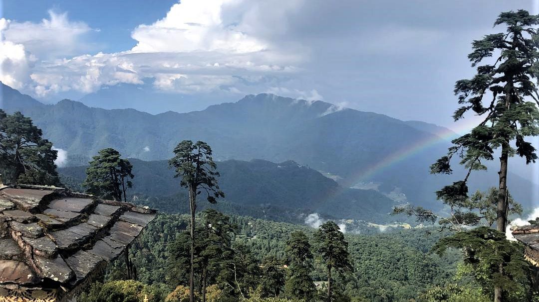
The country shares a tropical southern border with India whereas on the other hand, steep slopes climb to snow-capped heights of over 24,750 feet / 7,500m in the north sharing borders with Tibet. Consequently, temperatures vary greatly between day and night and at different altitudes. While travelling layered clothing is recommended for the rapidly changing climatic conditions.
In the central valleys, the summer rains are not as heavy as in the south. It rains mostly in the late afternoon and at night. From mid-May to the end of September, the weather is warm at night (60-64F/17-18C) and in the day (72-78F/22-26C). In winter, the sky is bright, and it is sunny but cold, especially when the sun hides behind the mountains in the mornings and evenings. At night, the temperature falls below zero. Spring and Autumn are very pleasant with warm days and cool nights.
Best Time to Visit Bhutan
Trips to Bhutan can be planned throughout the year although the ideal months are Mar, April, May, September, October, and November. Several festivals fall within these months & this is an added attraction. Winter in Bhutan is from mid-November to mid-March. At this time of the year, climate is dry and sunny for the most parts with a perfect blue sky. Temperature peak at around 15c in the daytime and falls below zero at night. The monsoon usually arrives in mid-June. There is light rain fall mainly in the afternoons and evenings.

Monsoon Season
July marks the advent of south east monsoon and this spell carries on till September. This brings much relief to the southern belt from the scorching heat. Farmers receive the eagerly awaited support to cultivate their rice fields. Rice is the primary food crop in the country. Thimphu, Paro & Punakha receive relatively less rainfall in comparison with the southern belt. Southern regions are the foremost to receive the moisture laden south east monsoon. The monsoons shed the bulk of moisture in this region. The valleys in the west and central Bhutan are on the leeward or rain shadow side, and hence the rain is fairly scant here. The valleys are carpeted with greenery in this weather. Trekking comes to a complete standstill as trails get wet, slippery and muddy.

Spring Season
Spring is between March and June. The southern regions experience typical sub-tropical weather and thus it is hot and humid. The days are warmer with cool nights and a clear blue sky. It is noticeably warmer in Punakha & Wangdue valley. This period offers an opportunity for high altitude treks. Rhododendron and other wildflowers dot the trails at higher altitudes. Many wild animals step out of their long spells of hibernation to make the most of the spring.

Autumn Season
Autumn begins towards the end of September and lasts till November. The weather stabilizes gradually after the monsoon. The skies start to clear up with the warm autumn sun. Spectacular views of far off mountain peaks are visible. These months are considered to be most favorable for Trekking. High mountain passes are accessible, and the temperature is stable. The epic Snowman trek is possible during this period of the year.

Winter Season
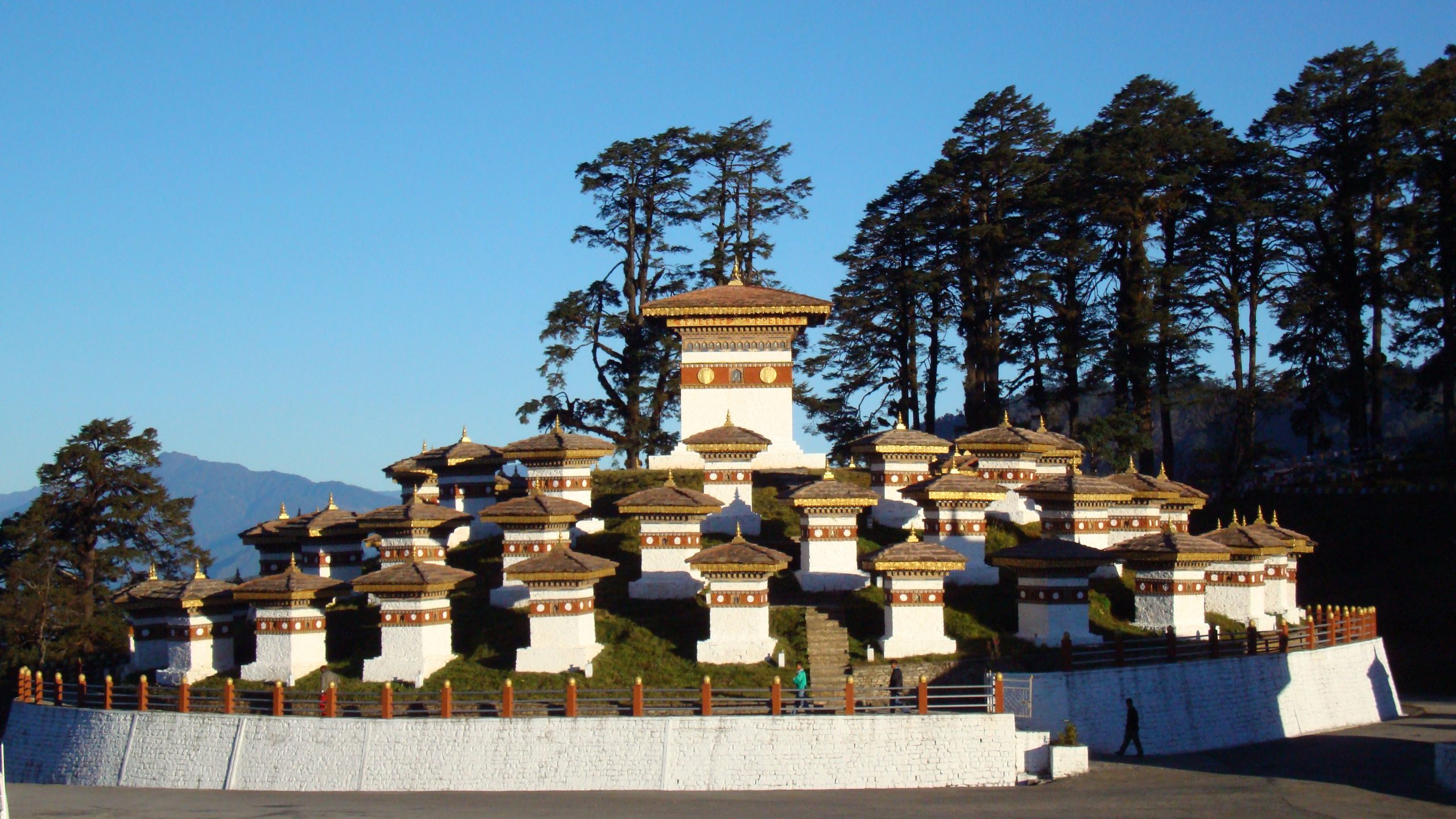
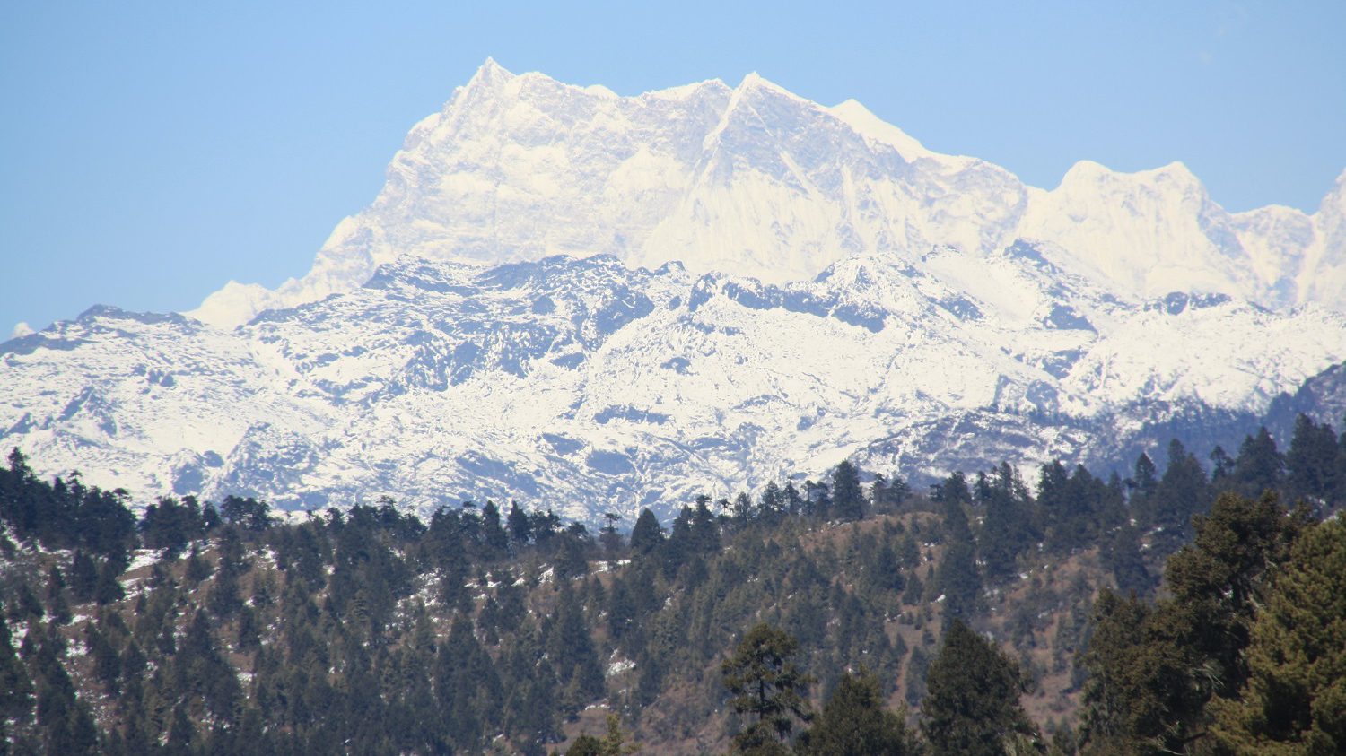
From mid Nov, the temperatures start dropping steadily. The winter season continues till February. Specifically, it’s the time of year when night tends to get cold with day being pleasant with bright sun. Blue winter skies serve a striking background to the snow-capped peaks. High mountain passes like Dochula pass, Pele La pass, Chele La pass experience snow but the valleys remain bereft of heavy snow with occasional light dusting of it. There is a possibility of heavy snow only if there is sudden and dramatic change in temperature.
Average Temperatures | In Celsius
January to June
| January | February | March | April | May | June | |||||||
| Places | Max | Min | Max | Min | Max | Min | Max | Min | Max | Min | Max | Min |
| Paro | 12.8 | 1.4 | 14.9 | 3.3 | 17.6 | 5.7 | 20.1 | 9.1 | 22.5 | 12.6 | 24.5 | 15.7 |
| Thimphu | 14.6 | -3.3 | 15.8 | -0.7 | 18.2 | 3.0 | 20.7 | 6.7 | 22.8 | 10.9 | 24.4 | 14.6 |
| Punakha | 17.5 | 5.8 | 19.3 | 8.1 | 22.2 | 11.2 | 24.9 | 13.8 | 27.3 | 17.2 | 29.2 | 19.3 |
| Wangdue | 17.8 | 5.5 | 19.4 | 8.1 | 22.7 | 10.8 | 25.5 | 14.4 | 27.3 | 17.8 | 28.2. | 20.3 |
| Trongsa | 17.5 | 5.6 | 19.3 | 6.2 | 22.3 | 10.4 | 23.9 | 13.5 | 23.6 | 14.5 | 24.7 | 17.2 |
| Bumthang | 11.0 | -4.2 | 12.5 | -1.3 | 14.8 | 1.9 | 17.1 | 5.7 | 19.4 | 9.4 | 21.7 | 12.9 |
| Mongar | 16.1 | 6.0 | 18.6 | 7.9 | 21.5 | 11.2 | 24.0 | 13.6 | 25.7 | 15.8 | 26.6 | 18.0 |
| Kangulung,T-gang | 13.6 | 2.5 | 15.6 | 4.6 | 18.8 | 7.3 | 21.1 | 10.4 | 22.7 | 13.3 | 23.7 | 16.2 |
| Deothang,S.jongkhar | 21.0 | 9.5 | 22.9 | 11.5 | 25.3 | 14.3 | 26.2 | 16.3 | 27.6 | 18.6 | 28.5 | 20.6 |
| Trashiyangtse | 12.3 | 3.6 | 14.8 | 6.2 | 16.7 | 8.2 | 19.8 | 11.1 | 22.2 | 14.2 | 23.2 | 17.0 |
| Zhemgang | 12.5 | 4.8 | 13.9 | 6.7 | 16.6 | 10.1 | 18.9 | 13.2 | 20.7 | 15.6 | 22.3 | 17.7 |
| Phuntsholing,Chukha | 23.9 | 16.2 | 26.5 | 5.1 | 29.5 | 18.2 | 31.1 | 6.3 | 32.4 | 20.9 | 32.6 | 10.1 |
| Sipsoo,Samtse | 20.5 | 13.3 | 22.7 | 16.1 | 25.7 | 19.0 | 27.3 | 21.0 | 28.0 | 22.6 | 28.3 | 23.9 |
| Damphu,Tsirang | 14.1 | 4.6 | 15.7 | 6.5 | 18.7 | 9.5 | 20.7 | 12.9 | 22.1 | 15.7 | 23.1 | 18.0 |
| Dagana | 11.0 | 6.1 | 12.3 | 7.2 | 16.1 | 10.9 | 19.7 | 13.7 | 21.9 | 15.7 | 23.2 | 17.6 |
| Bhur,Gelephu | 22.9 | 13.4 | 24.7 | 16.2 | 26.6 | 18.3 | 28.3 | 21.0 | 29.4 | 22.7 | 29.7 | 24.0 |
| Namjayling,Haa | 10.0 | -4.2 | 10.8 | -2.0 | 13.0 | 1.5 | 15.3 | 5.1 | 17.8 | 9.4 | 19.4 | 12.8 |
| Pema Gatshel | 16.6 | 5.6 | 18.1 | 7.3 | 20.6 | 10.1 | 23.0 | 12.7 | 25.0 | 15.2 | 25.9 | 16.9 |
| Khomachu,Lhuntse | 17.7 | 6.7 | 20.3 | 8.5 | 23.9 | 11.8 | 26.3 | 14.5 | 27.2 | 16.7 | 28.5 | 19.3 |
| Simtokha,Thimphu | 14.6 | -1.0 | 16.1 | 1.0 | 19.1 | 4.4 | 21.9 | 8.1 | 24.4 | 12.0 | 26.1 | 15.3 |
July to December
| July | August | September | October | November | December | |||||||
| Places | Max | Min | Max | Min | Max | Min | Max | Min | Max | Min | Max | Min |
| Paro | 25.4 | 17.9 | 25.2 | 17.4 | 23.5 | 15.4 | 20.4 | 11.0 | 15.8 | 6.3 | 14.0 | 2.6 |
| Thimphu | 24.8 | 15.9 | 25.1 | 15.4 | 23.8 | 13.6 | 21.2 | 8.0 | 18.3 | 2.2 | 16.0 | -2.1 |
| Punakha | 29.1 | 20.1 | 28.9 | 19.0 | 27.9 | 18.1 | 25.6 | 15.6 | 22.1 | 12.1 | 18.9 | 7.5 |
| Wangdue | 27.6 | 20.9 | 27.9 | 20.6 | 27.1 | 19.5 | 25.6 | 15.1 | 22.4 | 10.5 | 19.5 | 6.0 |
| Trongsa | 25.9 | 18.2 | 26.6 | 17.1 | 25.0 | 17.1 | 22.3 | 13.4 | 19.3 | 9.7 | 18.0 | 7.2 |
| Bumthang | 22.5 | 14.3 | 22.4 | 14.3 | 21.1 | 12.3 | 18.0 | 6.6 | 15.1 | 1.6 | 12.6 | -3.6 |
| Mongar | 26.8 | 18.5 | 27.8 | 18.3 | 26.8 | 17.1 | 24.4 | 13.7 | 20.7 | 10.0 | 17.7 | 7.2 |
| Kangulung,T-gang | 24.3 | 17.0 | 24.8 | 16.8 | 23.9 | 15.5 | 21.7 | 11.2 | 18.2 | 7.2 | 15.4 | 3.9 |
| Deothang,S.jongkhar | 28.8 | 21.1 | 29.4 | 21.2 | 28.9 | 20.1 | 28.1 | 15.9 | 25.9 | 14.1 | 23.0 | 11.1 |
| Trashiyangtse | 23.7 | 18.5 | 23.6 | 17.9 | 22.4 | 16.5 | 19.9 | 12.3 | 16.5 | 8.1 | 13.2 | 4.1 |
| Zhemgang | 22.8 | 18.2 | 22.8 | 18.2 | 21.9 | 16.9 | 19.9 | 13.5 | 16.9 | 9.8 | 13.9 | 6.3 |
| Phuntsholing,Chukha | 31.9 | 23.1 | 32.6 | 11.9 | 31.6 | 24.8 | 31.2 | 15.6 | 28.3 | 26.0 | 24.9 | 17.2 |
| Sipsoo,Samtse | 27.8 | 24.3 | 28.5 | 24.5 | 28.4 | 23.6 | 27.7 | 21.1 | 25.1 | 18.2 | 22.7 | 15.2 |
| Damphu,Tsirang | 23.5 | 18.6 | 24.0 | 18.3 | 23.4 | 17.2 | 21.8 | 13.4 | 19.2 | 9.4 | 16.3 | 5.8 |
| Dagana | 23.1 | 18.1 | 23.0 | 17.8 | 22.4 | 17.1 | 20.0 | 15.3 | 15.8 | 11.0 | 13.0 | 8.2 |
| Bhur,Gelephu | 30.2 | 24.3 | 30.9 | 24.7 | 30.4 | 24.1 | 28.9 | 21.2 | 26.7 | 17.8 | 24.1 | 14.7 |
| Namjayling,Haa | 20.3 | 14.2 | 20.3 | 13.9 | 18.8 | 21.2 | 16.4 | 6.4 | 13.8 | 0.8 | 11.5 | -3.1 |
| Pema Gatshel | 26.8 | 17.6 | 26.4 | 17.2 | 25.8 | 16.2 | 24.3 | 12.9 | 21.2 | 9.7 | 18.8 | 7.0 |
| Khomachu,Lhuntse | 28.9 | 19.6 | 29.3 | 19.7 | 28.2 | 18.7 | 25.6 | 14.8 | 22.7 | 11.4 | 18.4 | 7.9 |
| Simtokha,Thimphu | 26.8 | 16.5 | 26.7 | 16.5 | 25.5 | 14.8 | 23.1 | 9.3 | 19.2 | 4.1 | 15.8 | 0.0 |
